
Es dauerte etwas, doch dann erwischten wir noch eine hübsche Zelle bei Aspermont mit schönen Strukturen und zu frühem Outflow. Am Folgetag gab es noch nette Staubsauger zu sehen. See english summary below.
Unsere Strecke am 20.05.2017 (gesamt 538,5 km):
Donner und Regen zum Frühstück verheißen nichts Gutes. Ein Cluster aus der Nacht macht uns die Luftmasse und das Setup kaputt. Einziger Hoffnungsschimmer ist noch ein Streifen im westlichen Texas, wo der CAPE schon etwas angefressen, aber noch brauchbar ist und vielleicht noch einzelne Zellen produziert werden. Weiter nord- oder ostwärts möchten wir nicht. Die Vorhersage ist heute nicht so einfach, die Erwartungen reduziert.
Wir machen uns auf in Richtung Guthrie (3h Fahrt) und müssen erstmal den riesigen Schirm des MCS hinter uns lassen. Dahinter steigen die Temperaturen etwas an, Ac cas zeigen sich nach Westen und bald zieht wieder Stratus auf, der der die Konvektion limitiert. Am Zielort angekommen, hatten es derweil die ersten einzelnen Zellen probiert und zogen in unsere Richtung.
Abwarten hieß die Devise mit 3 anderen Chasern, davon einem älteren Ehepaar. Dem Mann wurde schnell der Titel „Chaser-Opi“ verpasst. Nach einiger Zeit brachen wir nach Süden auf um bessere Sicht zu bekommen. Immer wieder poppten Zellen auf und verpufften so schnell wie sie kamen. Letztlich sollte die rechte Zelle die Show machen:
Wir machten uns auf in Richtung Jayton. Unterwegs überholte uns ein Chaser mit nicht unerheblicher Geschwindigkeit, den wir später wieder am Straßenrand mit der Polizei stehend überholten. Danach war er noch mehrmals hinter uns, aber fuhr irgendwie so langsam ;) Unsere Zelle dagegen konnte beruhigt Fahrt aufnehmen und verstärkte sich, Rotation im Doppler durchaus erkennbar. Der Inflow raste über die Felder, spannender Anblick.

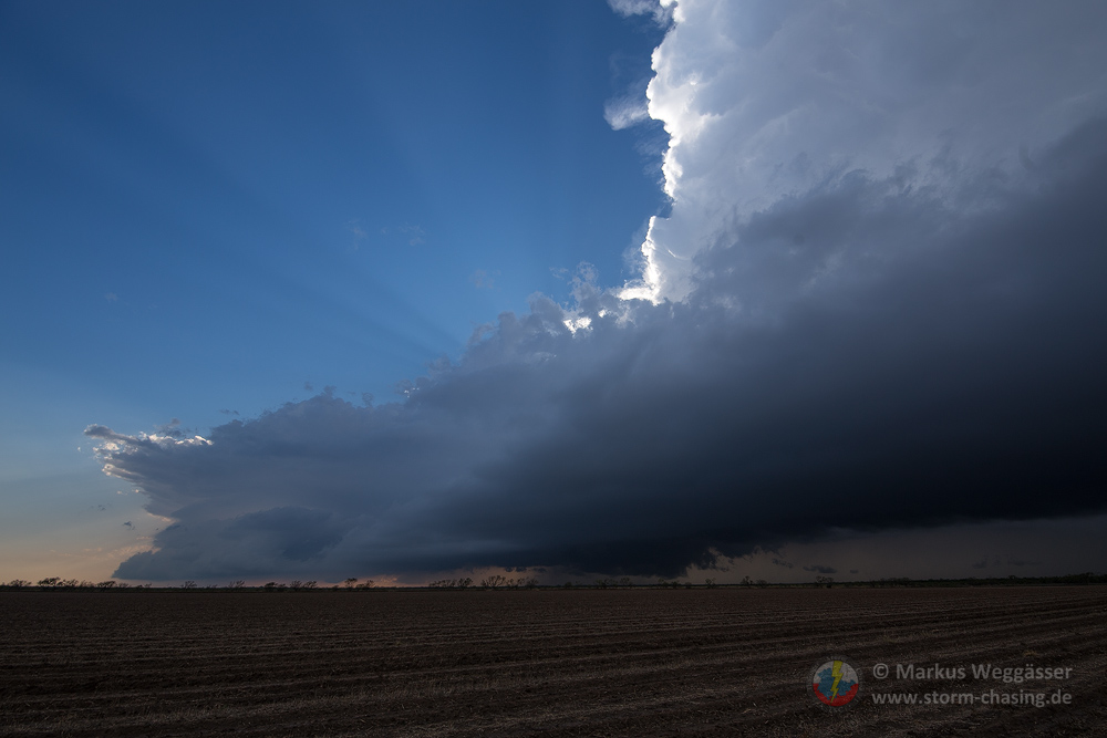
Wir fuhren weiter südwärts und hielten bei Aspermont nochmal kurz zum Beobachten an:


Leider war die zunehmende Dominanz des Ouflows zu erkennen, Strukturen aber dennoch brauchbar. Wir wichen wieder ostwärts aus mit Südoption. Inzwischen mit kleiner Chaser-Konvergenz an Aspermont vorbei nach Hamlin zeigte sich die beste Struktur, wo wir mehrmals anhielten. Das war noch ein schöner Treffer für den Tag, der anfangs durchaus zum Bust zu neigen schien.
Einquartiert haben wir uns in Abilene. Auf der Fahrt konnten wir noch prächtige Cb’s nach Süden sehen, die Teil einer Linie waren, die bei San Angelo immer wieder anbaute und aktiv blieb. Auch unsere Zelle hielt noch länger durch und zeigte sich feurig im Abendrot. Wir checkten im Motel ein und hatten Abendessen bei Whataburger mit Chlor-Pepsi – lecker.


Wir entschieden uns gegen das Setup im Süden von Texas für den nächsten Tag, um wieder nach Norden zu fahren, wo wir einerseits Heiko treffen werden und ab Sonntagabend nochmal neue Chancen haben.
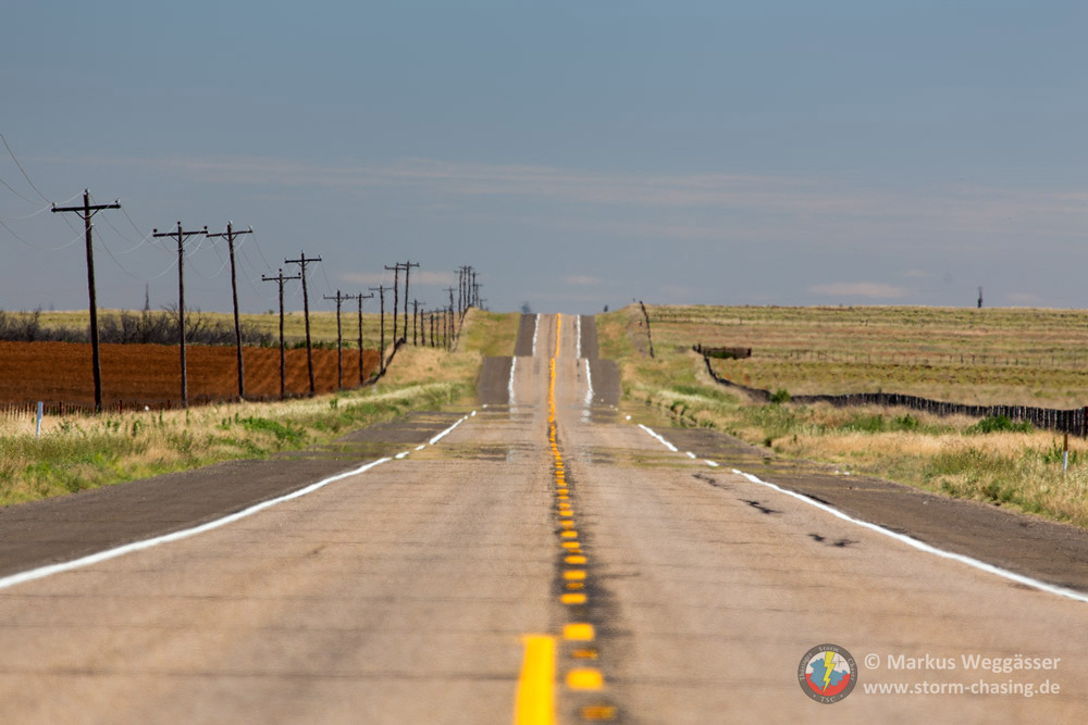
Auf dem Weg nach Norden hielten wir nochmal für ein paar hübsche Dust Devils. Und wo immer was rotiert sind auch andere Chaser rein zufällig da. In dem Fall das italienische Team mit denen wir noch bisschen quatschten und drehenden Staub begafften. Zum Schluss checkten wir in Childress in einem hübschen Motel mit ausreichend WLAN ein.


May 19: Waking up, grey skies and light rain welcomed us in the morning. On to the routine check of the weather maps, and a setup we hoped would make for a great chase day had turned into a mediocre joke version of a setup overnight. The rain outside was just the visible expression of what was to blame for the deteriorated outlook.
A line of thunderstorms would keep firing up along the cold front, eating up potential energy for better storms later in the day. That’s what happens if the airmass isn’t sufficiently capped or the synoptic forcing (cold front in this case) is simply to strong to suppress convection.
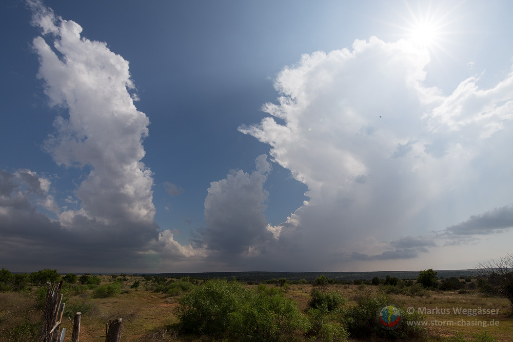
All we were left with was the hope of some afternoon storms west of the cold front at the dryline. Outflow boundaries and large scale synoptic lifting would help firing up discrete cells with potential for some pretty storm structure.
Four hours later and deep into SW-Texas (Guthrie), we eventually reached the 25 degree barrier and got some sunshine. Clearly, that air wasn’t as warm and buoyant as we would have liked, but it’s not on us to choose. You gotta deal with what you’ve got.
A few attempts of storms to fire later, one cell looked more promising. We positioned ourselves as close to the storm base as possible. Turned out this guy has really managed to find juicy air and sustained forcing. It ingested large amounts of surrounding air into the updraft, causing intense inflow winds which picked up dust from the farm lands around.
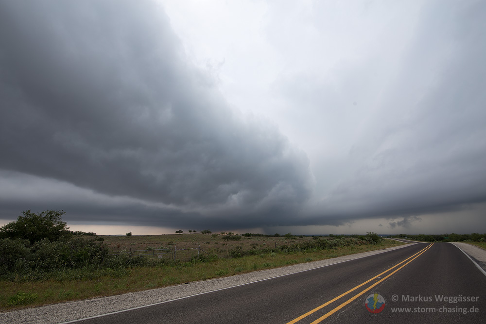
There was a second, less active updraft visible, which indicated that it wasn’t too well structured of a storm. While certainly supercellular in character, it didn’t manage to evolve into one discrete cell. While the storm structure was fairly impressive, the storm mode would eventually turn outflow-dominant.
As soon as we got taken over by the cold outflow winds, we moved on, trying to stay far enough ahead of the storm so that we’d get some pretty shots of the developing shelf- or role cloud.
But the storm did lose it’s dynamics rapidly. All we were left with after a while, was a band of clouds which indicated the leading edge of the outflow boundary of our storm. The day ended with a view of towering Cbs and anvils to the west and a sky full of mammatus clouds from the line of storms to the north and west. Abilene, TX is where we decided to spent the night.
May 20: Since cold air has flooded the Great Plains almost in its entirety, no action was forecast for today. We repositioned to Childress where the most enthusiastic group member had some fun with dust devils on our way. For the remainder of the day we enjoyed very fast internet in the motel for once.
What a change when you can actually do some work without the constant pain of waiting, or worse, total loss of connection as is otherwise the default state of motel wireless. An hour before midnight, our last team member for this years trip, Heiko, arrived after a long day on the plane and the road from DFW.
 Auf unserer Hompeage sind schon so viele Gewitter und Stürme unterwegs gewesen, dass es Zeit wird, mal wieder gründlich aufzuräumen und zu putzen. Das nutzen wir gleich zum Umbau und zur Platzierung einiger neuen Dinge in diesem Jahr.